Deep Freeze Expected After Snowfall in New Jersey This Week

State of Emergency in NJ: Preparations for Imminent Winter Storm
January 18, 2025
Winter Weather Alert: New Jersey Prepares for Arctic Blast
January 19, 2025Deep Freeze Expected After Snowfall in New Jersey This Week

Deep Freeze Expected After Snowfall in New Jersey This Week
Here we go! If the snow and rain are not removed from vehicles, driveways, sidewalks, pavements ,etc. ,they will freeze overnight. For the majority of the week, temperatures won't rise above freezing.
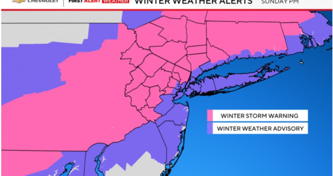
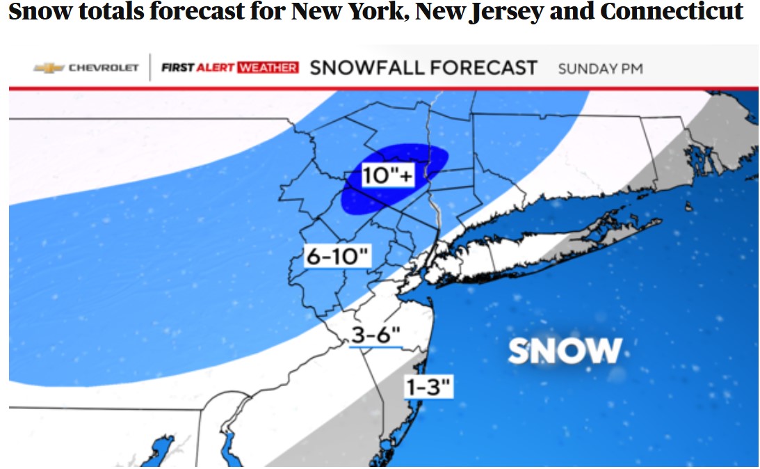
Steadiest snow so far is N&W of I-95 and more so, N & W of I-287. Not unusual as cold air arriving first there along with your elevation. Wet snow or a mix of rain, sleet and snow from the City, east and south. But as low pressure develops and moves off the NJ coast, temperatures will begin to tumble.
It's already, well below freezing aloft and it just needs to get down to the surface. The storm may not be a powerful one but will do the trick with cold air transport.
Everyone gets accumulating snow this evening. Expect rapidly deteriorating travel conditions after dark for the whole region. Thankfully it's a quick-mover and ends within a few hours either side of midnight from west to east. But beware, treacherous travel linger. Temps will crash and anything on the ground will freeze into a sheet of ice. Hasn't been bad yet but this a moderately impactful storm by the time its done according to the National Weather Service.
Overnight, icy conditions are a worry. Be prepared for occasional wind gusts of over 20 mph. This may momentarily impair road visibility, so if you must go out, give yourself plenty of extra room, take your time, and slow down.
The upcoming week will see some very harsh temperatures. Temperatures that will feel like zero or as low as five degrees below are the subject of an advisory. Given that the temperature will already be lower, elevation will make this feel more brutal.
According to Accuweather, snow this evening, accumulating 1-2 inches; otherwise, mostly cloudy, breezy and colder; storm total 2-4 inches; streets will be slippery.
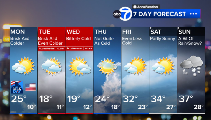
Monday will be blustery and sharply colder with a wicked wind chill.
Tuesday and Wednesday are AccuWeather Alert days with highs in the teens.
With the wind, many of those numbers will feel more like zero.


