Nor’easter Snowstorm Threatens New Jersey Later This Week

A Powerful Storm System Will Impact the Region Today
February 16, 2025
Tragic Incident: Man Struck and Killed by Cars on Garden State Parkway
February 16, 2025Nor’easter Snowstorm Threatens New Jersey Later This Week

Nor'easter Snowstorm Threatens New Jersey Later This Week
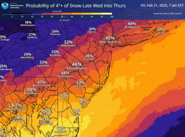
The initial snowfall projection map for a winter storm anticipated to impact New Jersey starting Wednesday evening indicates 3 to 6 inches of snow for the southern counties.
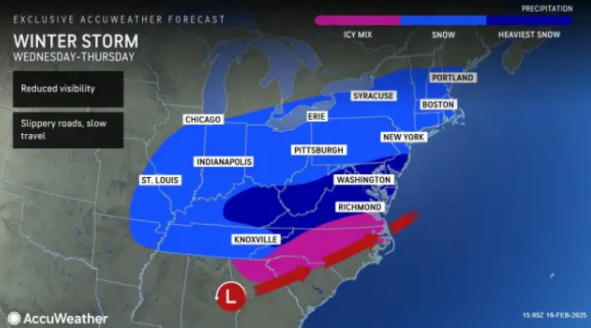
According to AccuWeather's forecast, central New Jersey is expected to see 1 to 3 inches of snow, while regions north of I-80 may not experience significant accumulation.
This forecast is based on a more southerly path of the storm. Maryland, Delaware, and Washington, D.C. are predicted to receive 6 to 12 inches of snow.
AccuWeather Senior Meteorologist Courtney Travis stated that the arrival of snow in certain areas along the Interstate 95 corridor on Wednesday afternoon could pose significant challenges. She noted that snowfall in the afternoon in cities such as Washington and Baltimore may result in quickly worsening travel conditions as the afternoon progresses into the evening commute.
Should the storm shift northward and track along the East Coast, meteorologists predict that significant snowfall may occur in northern New Jersey, New York City, and Boston.
The weather service indicates that the likelihood of New Jersey receiving over a foot of snow ranges from 15% to 25%.
This recent storm comes on the heels of a period of significant weather activity in New Jersey, which included intense rainfall and strong wind gusts reaching up to 60 mph on Sunday.
High wind warnings are currently in place across a large portion of the state, and temperatures are anticipated to drop below freezing tonight. The cold conditions are expected to persist throughout the week, leading up to the storm forecasted for Wednesday and Thursday.


