
NJ Weather Forecast: Potential Severe Thunderstorms

NJ Spa Scandal: Woman Charged with Money Laundering in Monmouth & Ocean Counties
May 26, 2026
Ocean County Residents Face Serious Charges for Drug Distribution
May 27, 2026NJ Weather Forecast: Potential Severe Thunderstorms

NJ Weather Forecast: Potential Severe Thunderstorms
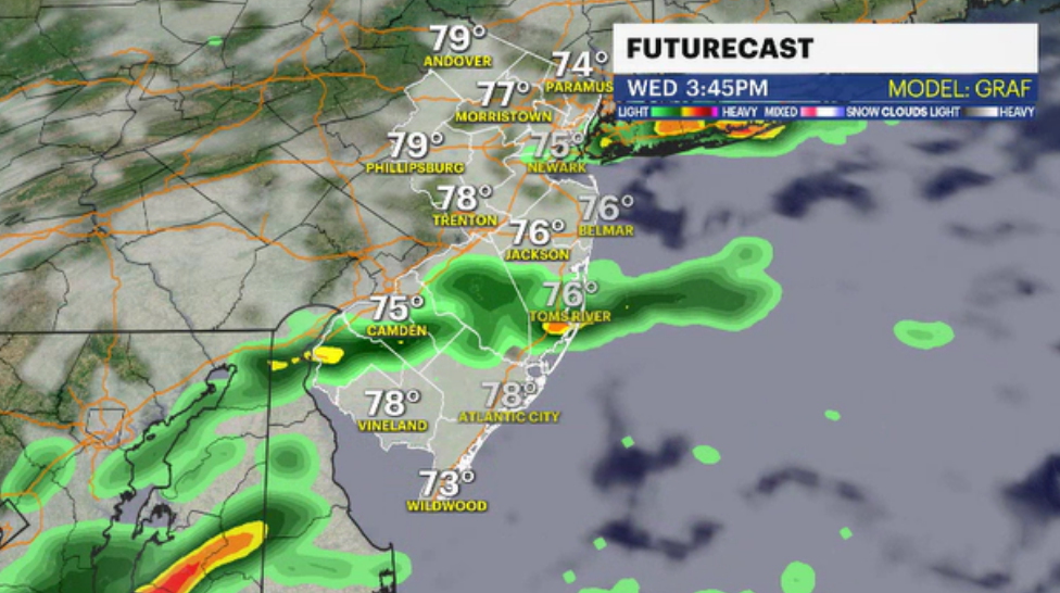
According to the National Weather Service, a front to our south tries to move northward later tonight and Wednesday. Some showers and thunderstorms are expected, with some severe weather potential across mainly Delmarva Wednesday afternoon and early Wednesday evening. The thunderstorm risk will depend on how far north the front gets.
The general weather pattern is still unpredictable. Just to the south, a stationary weather system will begin to move clouds and showers onto New Jersey on Tuesday night and continue to do so for the most of Wednesday. The majority of the state won't be dealing with a showery forecast, and Wednesday doesn't appear to be a washout. Indeed, there will be intermittent periods of sunshine north and along I-80.
Wednesday is cloudy for the most part. Despite the cloud cover, a fairly favorable wind from the southwest will enable temperatures to rise into the low 80s. The southern and central regions of New Jersey may experience passing showers. Along and south of Route 72 from Philadelphia to Long Beach Island is the finest location for more reliable rainy weather. For the remainder of the Garden State, there will just be splash-and-dash wet weather.
Starting on Thursday, pleasant weather is expected. Canada and the western Great Lakes will bring in higher pressure, which is linked to sunny and drier weather. The sun should continue to shine throughout the weekend, but temperatures will drop back into the low 70s.
Keep up-to-date with the latest forecast.


